
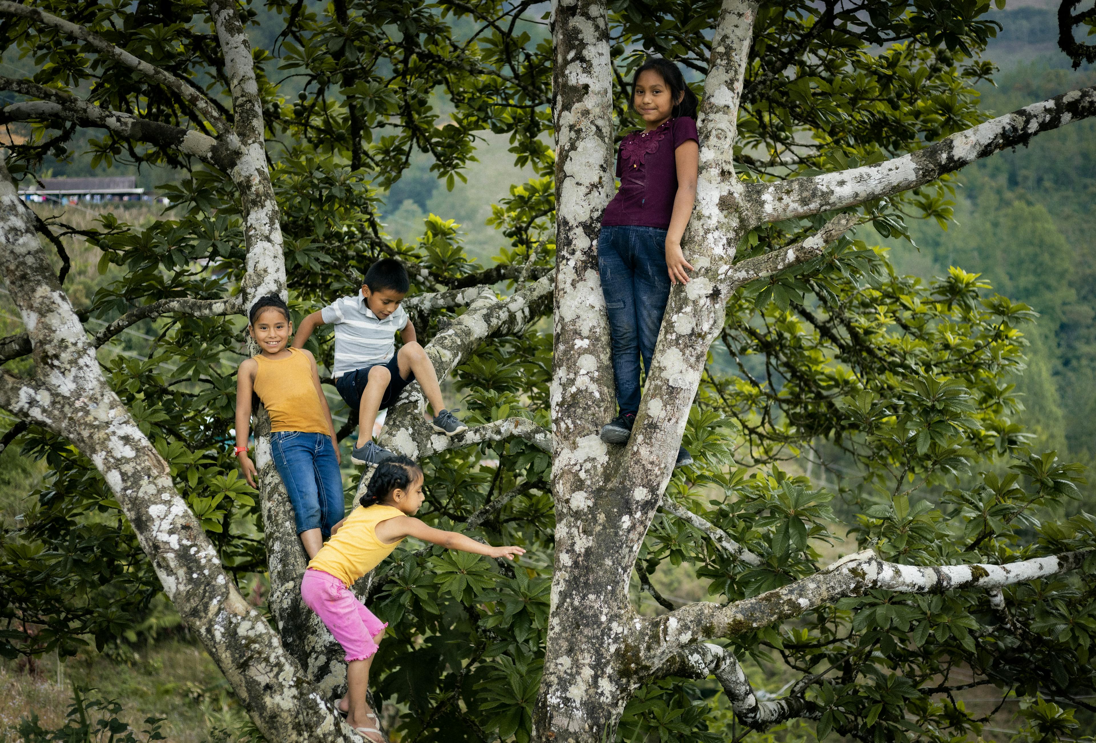
The Good News, May Edition
Innovation and Tech: the tools to build a climate resilient future.
With the fast adoption of green technologies, it’s highly possible that global carbon emissions will start decreasing this year, putting the worst of the climate crisis behind us- but only if we stay vigilant.
Sounds like a complete fantasy right? But according to many experts and think tanks, like Climate Analytics, this is very likely already happening.
Whilst the effects of climate change have caused unbelievable harm over the last decade, many agree that the silver lining is the uptake of cleaner, and more efficient technologies. Electric car sales together with solar and hydro alternatives to energy are on the rise, and here in New Zealand, Climate Change Minister Simon Watts, recently said: ‘Clean Energy is behind the country’s lowest greenhouse gases since 1999.
Aotearoa has cut its harmful carbon emissions for three years in a row with the recent drop being the biggest since the country adopted a more strategic approach to addressing climate change.
All across the world, UNICEF and our partners work tirelessly to solve complicated climate-related problems affecting children and their communities in compounded ways. Innovation and technology are how we do this. These are just a few examples.
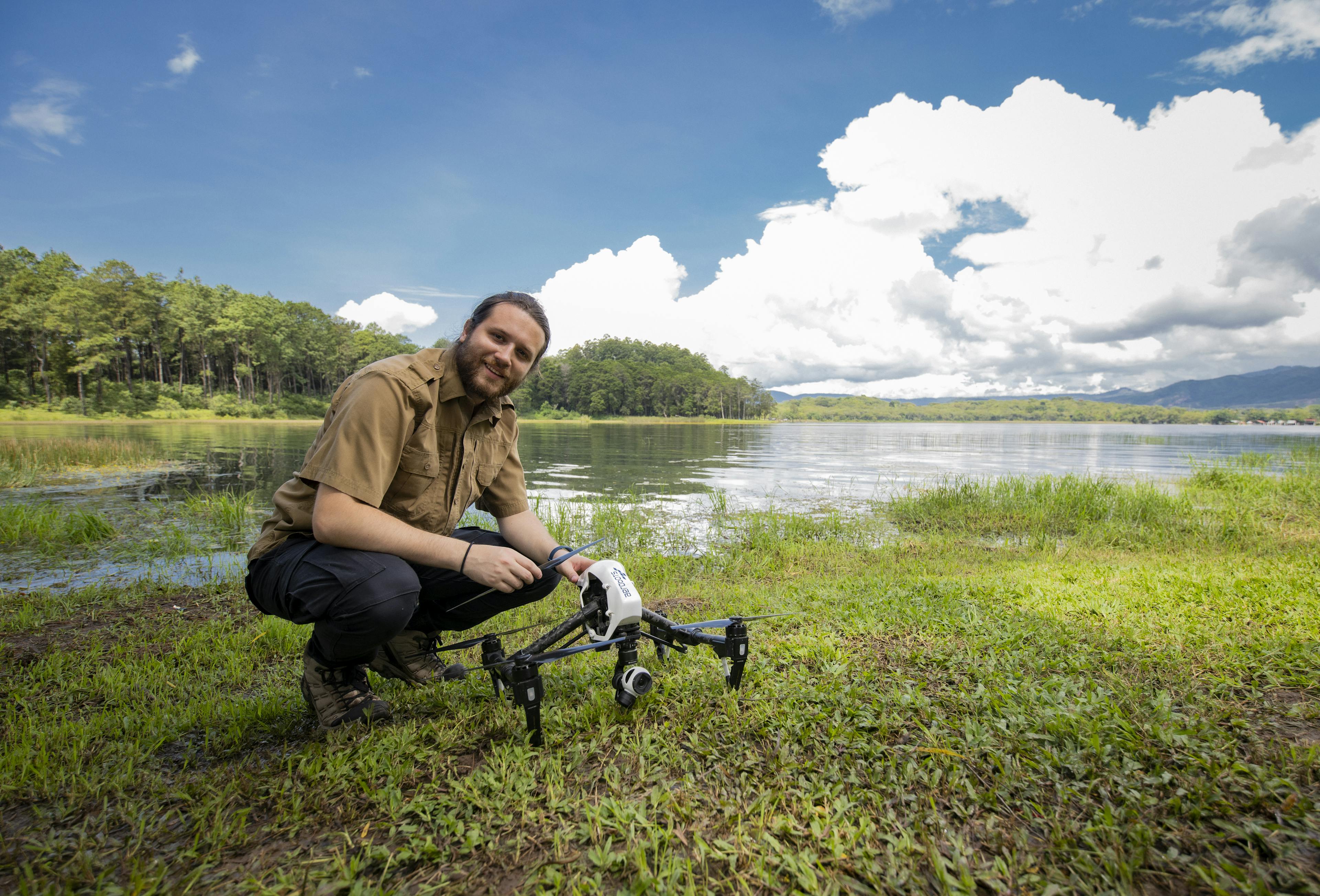
Guatemala's Dronebots
When 27-year-old Dan Alvarez was a kid, he dreamed of working in space. Graduating as an electrical engineer, today, he’s working in partnership with UNICEF to develop drones that transmit essential real-time data during natural disasters.
Guatemala ranks in the top five countries most affected by climate-induced natural disasters (floods, hurricanes and earthquakes), with 40.8% of the population exposed to five or more threats simultaneously. Parts of the country most prone to disasters and emergencies often lack stable electricity and internet connections, making it difficult to collect important risk information during or immediately after a crisis. The data collection system used by the National Coordinator for Disaster Reduction (CONRED) during recovery efforts is slow and heavily dependent on internet and mobile phone connections.
UNICEF partnered with local agricultural drone start-up Aerobots to develop the first drone emergency response prototype in Guatemala. Dan and his team worked according to two main guidelines: 1) to develop an emergency drone system with connectivity independent of satellite, mobile, and internet networks; 2) and during climate-related emergencies and natural disasters, the drone system should identify real-time data on affected communities ranging from evacuations and temporary shelter to damaged infrastructure such as homes and schools.
And so the innovative Dronebots project was born. Simply put, Dronebots establish a communication network between decision-makers, drone operators, and local volunteers saving lives when every other network fails. Dronebots, incubated by the UNICEF Office of Innovation, won the SPARK award and is being supported to scale nationally with the goal being a rollout internationally.
Drones in Malawi
The Rukuru River is to the Karonga and Rumphi districts of Malawi what the Nile River is to Egypt: a source of life. It irrigates maize, rice, and banana fields, and replenishes rivers where families fish for sustenance and commerce.
Most of the time, the river peacefully cascades down from the mountains in the Chitipa district. However, since the 1970s, the Rukuru River has presented some unwelcome surprises to the people in Karonga and Rumphi: destructive floods that devastate property and claim lives.
Over the past few years, both the frequency and the intensity of these occurrences have escalated. Every time it rains, the river breaches its banks, ruining houses, schools, farms, and livestock, exacerbating hunger and poverty among already vulnerable communities.

To lessen the impact of these floods on vulnerable families, UNICEF Malawi, with backing from UK-based company ARM and UNICEF's Office of Innovation, has initiated a pilot project in the two districts. This project, an impact-based flood forecasting and early warning system, leverages high-resolution aerial imagery to support flood modelling, thereby establishing the basis for flood forecasting in disaster risk reduction.
UNICEF commissioned Globhe to collect aerial photos and generate digital terrain models for flood-prone areas. Globhe's platform is the largest drone data marketplace in the world, with a coverage of 134 countries, and connects drone operators with clients in need of drone data. Utilising this data, a high-resolution flood model was developed, which accurately predicts the timing, location, and magnitude of floods and mapping out potential flood paths.
The drone aerial data capture team was led by Alexander Mtambo, a former student of the UNICEF-supported African Drone and Data Academy (ADDA), who currently serves as the Head of Drones Africa at Globhe.


"Our participation in a project like this goes beyond showcasing the advanced technical skills we, as Malawi's youth, now possess. It also demonstrates how these skills can be harnessed to improve the lives of children and their families. Floods can displace families, forcing some to live in camps with inadequate water and sanitation facilities, thereby exposing them to diseases like cholera. Our involvement in this project can enhance the lives of children by providing their families and the government with information that can prevent them from finding themselves in such situations in the first place," Alexander Mtambo.
Satellite groundwater
mapping in Ethiopia
East Africa and Southern Africa are home to millions of people who are some of the most vulnerable, in the world, to water shortages. Without clean water, children get diseases and experience food insecurity. But how do you get clean water in some of the most arid terrain on the planet? The answer lies below our feet.
Groundwater is the most viable water source in areas with low rainfall. Drilling for water is necessary for these regions to survive and thrive, but complex geographical terrain has resulted in low drilling success rates. Furthermore, without accurate and effective underground drilling—and better understandings of how groundwater is refilled, or “recharged" from rainwater—drought remains a critical threat to millions of children.
UNICEF’s More Water More Life - Groundwater Mapping Project Using Satellite Data provides a fresh take on drilling. It was designed to increase the drilling success rate for groundwater by mapping deep aquifers—bodies of permeable rock that can contain groundwater—with satellites and science. Since 2017, UNICEF has collaborated with the European Union Joint Research Centre (EU-JRC) to develop this new way of mapping groundwater using geospatial imagery and data.

Together, EU-JRC and UNICEF found a way to use satellite images in conjunction with conventional exploration techniques to reduce the time and resources required for groundwater feasibility studies. More Water More Life’s data-driven approach helps find groundwater before drilling. This saves time and money. In fact, the initiative delivers clean water at around 50 cents per person. This is great value for money when compared to other technologies that cost thousands of dollars more, but find water less than half of the time. Perhaps most importantly, the groundwater is extracted in an environmentally sustainable way, meaning there aren’t long-term environmental or socioeconomic consequences like aquifer depletion.
The More Water More Life initiative has already been successfully piloted in Ethiopia and Madagascar. Because of this innovative new technology, drilling success rates almost doubled in Ethiopia, increasing from 50% to 92%. This directly improved water access for 1.2 million people, with 740,000 of them being children. It also proved that by incorporating data and scientific methods into the drilling process, this ground-breaking innovation has more than doubled the success rate for underground drilling. The need and solution are clear. This innovative approach to drilling must be scaled. The technology to find groundwater exists. Now it’s time to share it.

